Photo by Gordon Campbell | At Altitude Gallery
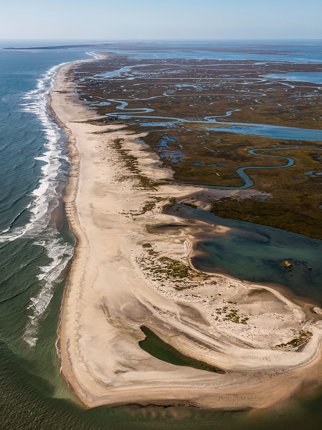
Cedar Island
Owned and managed by: The Nature Conservancy Virginia Coast Reserve, the U.S. Fish and Wildlife Service Chincoteague National Wildlife Refuge, and the Virginia Marine Resources Commission. BE AWARE: Private inholdings exist and visitors should respect property boundaries.
Portions of Cedar Island that are owned by TNC, USFWS and VMRC are open year-round to the public for low-impact, recreational day use, such as hiking, bird watching, surf fishing and photography. Within these portions, all areas above the high tide line are closed April through August. Please help protect sensitive habitats and wildlife by observing all visitation policies and seasonal restrictions. See below for additional details on visitor information for the north end of Cedar Island (north of the Coast Guard Station) often referred to as Cedar Sandbar.
Visiting Cedar Island
The Seaside is a dynamic landscape with constantly shifting tides, sands and weather. Safety is a top concern when visiting this remote area with limited accessibility and services. Stay alert, come prepared and be aware of island use policies.
Open for recreational DAY use:
![]()
![]()
![]()
![]()
Prohibited at ALL times:
![]()
![]()
![]()
![]()
Open for recreational DAY use on Cedar Sandbar:
![]()
![]()
![]()
![]()
![]()
Prohibited at ALL times on Cedar Sandbar:
Seasonal restrictions (April through August):
For information about our policies, please contact:
- The Virginia Coast Reserve office at (757) 442-3049 or visit their website.
- The USFWS Chincoteague NWR at (757) 336-6122 or visit their website.
Suggested access points
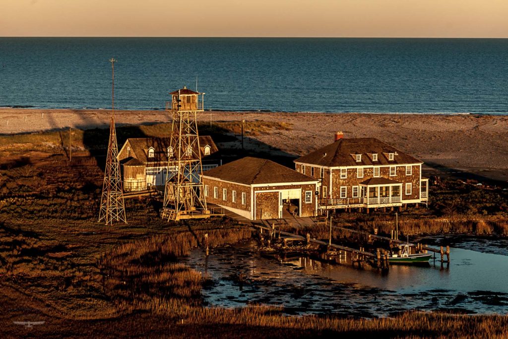
Cedar Island is most easily and safely accessed via the inlet beaches at the north (Metompkin Inlet) and south (Wachapreague Inlet) ends of the island. Access to other parts of the island requires extensive knowledge of the waterways and is not recommended for inexperienced visitors. The Cedar Island Coast Guard Station at the north end of the island is privately owned and not open to the public.
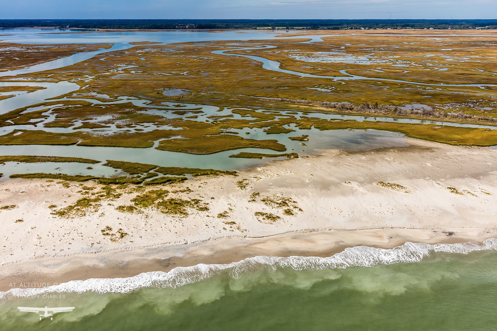
Photo by Gordon Campbell | At Altitude Gallery
About Cedar Island
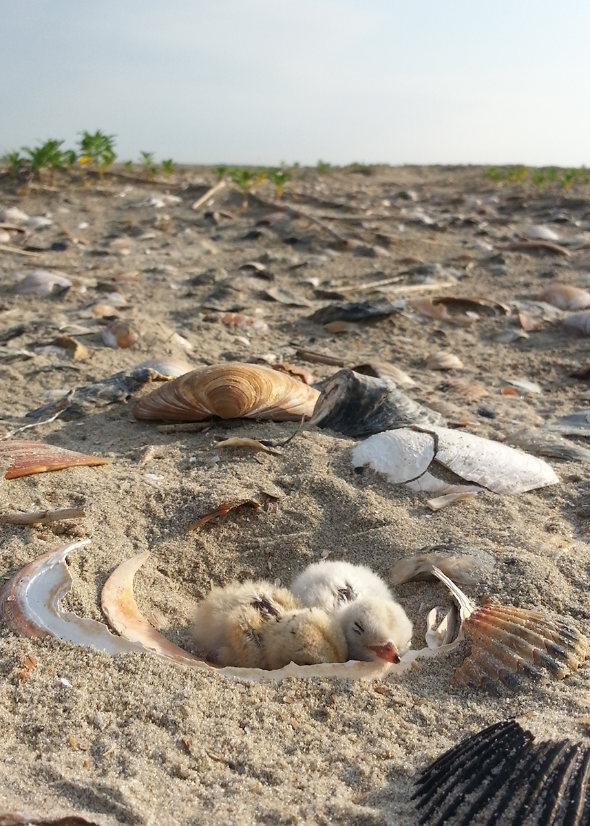
Cedar Island is one of Virginia’s most important coastal sites for migratory birds. During the spring and summer months in particular, the dynamic beaches and marshes support incredible numbers of nesting and migrating birds attempting to successfully raise young right here along our coast or rest and fuel up for long migratory journeys to breeding grounds north of here. Cedar Island’s high energy sandy beaches and pristine marshes provide just what they need. The island’s close proximity to the mainland makes the island a popular destination for visitors, so managers aim to balance recreational use with the protection of sensitive habitats and wildlife. Before visiting, please familiarize yourself with site use policies and seasonal restrictions in order to help maintain this balance.
A complex history for Cedar Island has resulted in a unique pattern of land ownership across the site. In the 1950s, the island was subdivided into hundreds of lots platted for residential development. The development project, however, never succeeded due to natural island migration processes. Over the years many of those lots were purchased by or donated to The Nature Conservancy and the U.S. Fish and Wildlife Service. Today, the majority of the island is owned and managed by these two entities but private inholdings remain scattered across the landscape. The northernmost mile of the island, north of the Coast Guard Station and often referred to as Cedar Sandbar, is managed by the Virginia Marine Resources Commission. Since determining where exact property boundaries are at the site is difficult, visitors are encouraged to follow the use policies set by these agencies in order to protect sensitive natural resources and be aware the private inholdings exist and property boundaries should be respected.
Discover a Coastal Wilderness
The Atlantic coastline of Virginia’s Eastern Shore is a unique coastal wilderness that spans 70 miles from the Virginia/Maryland border to the mouth of the Chesapeake Bay. The region is characterized by vast, mostly undeveloped marshes, barrier island beaches and coastal lagoons that support globally important populations of migratory birds, are the site of intensive large scale oyster reef and eelgrass restoration projects, and provide extensive recreation opportunities in remote settings. Learn more about the natural history of this amazing coastal landscape.
OWNERSHIP AND LAND MANAGEMENT
The Nature Conservancy Virginia Coast Reserve
The Nature Conservancy is a global conservation organization dedicated to conserving the lands and waters on which all life depends. Guided by science, the Conservancy creates innovative, on-the-ground solutions to our world’s toughest challenges so that nature and people can thrive together.
The Virginia Coast Reserve (VCR) is a landscape program within the Virginia Chapter of the Conservancy that is headquartered in Nassawadox, Virginia on the Eastern Shore. VCR is made up of 14 barrier and marsh islands, extensive salt marshes and several mainland properties including the Brownsville Preserve. Programs at VCR address conservation topics on the Eastern Shore such as migratory bird conservation, marine habitat restoration, coastal resilience, land protection and outreach and education. VCR works collaboratively with federal and state partners to manage The Nature Conservancy’s properties, including the barrier islands and Brownsville Preserve, to ensure the protection of sensitive natural resources while also accommodating for low-impact visitor use.
U.S. Fish & Wildlife Service
Chincoteague National Wildlife Refuge Complex, including Chincoteague, Eastern Shore of Virginia and Fisherman Island National Wildlife Refuges, is just one of more than 560 in the National Wildlife Refuge System, administered by the U.S. Fish & Wildlife Service. The National Wildlife Refuge System is a network of lands and waters encompassing 150 million acres. These special places are managed specifically for the protection of wildlife and wildlife habitat. The Refuge System represents the most comprehensive wildlife resource management program in the world. Units of the system stretch across the United States, from northern Alaska to the Florida Keys. It also includes small islands in the Caribbean and South Pacific, as well as Marine National Monuments such as the Mariana Trench. The character of the refuges is as diverse as the nation itself and these protected lands provide habitat for more than 700 species of birds, 220 species of mammals, 250 reptile and amphibian species and more than 1,000 species of fish. More than 380 threatened or endangered plants or animals are protected on National Wildlife Refuges.
Virginia Marine Resources Commission
The Virginia Marine Resources Commission (VMRC) serves as the steward of the Commonwealth’s marine and aquatic resources, and protectors of its tidal waters and homelands. It manages recreational and commercial saltwater fishing and works to create and maintain sustainable coastal fisheries. VMRC also manages a significant portion of the state’s tidal marshes and water bottoms to ensure the long term protection and productivity of these sensitive habitats.
Explore Our Seaside Partners
The seaside of Virginia’s Eastern Shore is almost entirely owned and managed by non-profit, state and federal agencies. These partners share the common goal of protecting natural resources, while balancing sustainable recreational and economic use of the seaside. Learn more about our partnership.